Experience Aeronautical Precision
Commercial drone services in Connecticut
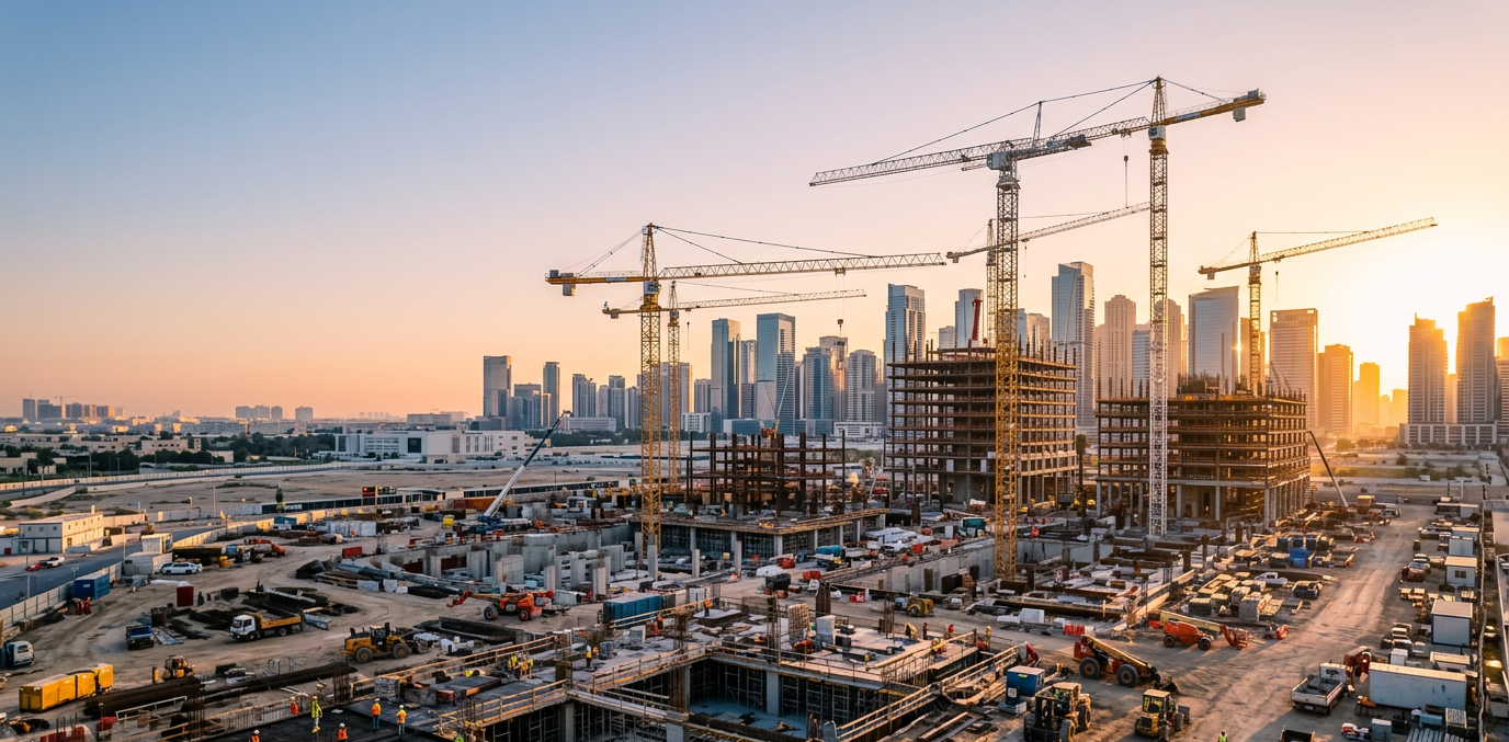
Construction progress monitoring
Mapping
Facade, roof and tower inspections
Digital twin and 3D Modeling
FAA Certified - Fully insured - Fast turnaround
Our mission
Provide clear, high-quality aerial images and videos that help clients see what cannot be easily viewed from the ground.
Use drone technology to make inspections, marketing, and documentation faster, safer, and more cost-effective.
Deliver reliable service with straightforward communication and timely results.
Who we work with
Civil engineering firms
Construction companies
Property management
Commercial real estate
Surveying firms
Telecom & utilities
Insurance inspectors and adjusters
Safety + Compliance
FAA Part 107 compliant
Weather and wind limits followed
Insured operations
FAA Certificate # 4156604
Get a Fast project quote - receive estimate within 24 hours
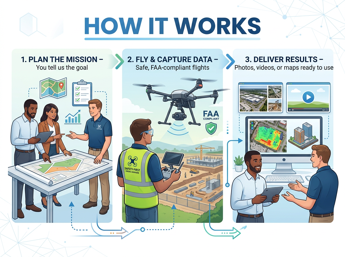
How It Works
Plan the Mission – You tell us the goal
Fly & Capture Data – Safe, FAA-compliant flights
Deliver Results – Photos, videos, or maps ready to use
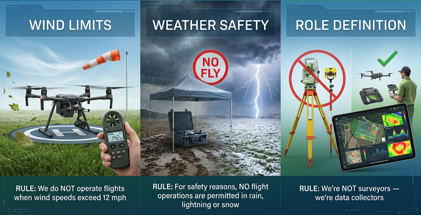
Our rules
We do NOT operate flights when wind speeds exceed 12 mph
For safety reasons, NO flight operations are permitted in rain, lightning or snow
We’re NOT surveyors — we’re data collectors
Why Coordinate Systems and Geodesy Matter in Drone Mapping
Accurate drone mapping is about much more than simply flying a drone and capturing images. Behind every reliable map, 3D models, or digital twin is a scientific foundation called geodesy.

Geodesy is the science of measuring and understanding the Earth’s shape, position, orientation, and gravity field. Since the Earth is not perfectly round or uniform, professionals use standardized reference systems to define precise locations both horizontally and vertically.
This is the backbone of modern surveying, mapping, and construction workflows.
Turning Drone Images Into Accurate Data
When creating drone maps and models, our goal is to produce a precise digital representation of a real-world site. Every image captured by the drone contains GPS positioning information that helps place the data accurately on the Earth.

This allows construction teams, engineers, and project managers to:
Measure existing site conditions
Calculate elevations and material volumes
Track progress over time
Compare existing terrain to proposed designs
Make informed planning decisions
Why Coordinate Systems Matter
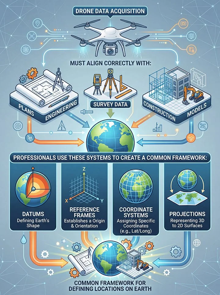
For drone data to be useful, it must align correctly with engineering plans, survey data, and construction models.
Professionals use systems called:
Datums
Reference frames
Coordinate systems
Projections
These systems create a common framework for defining locations on Earth.
One of the most widely used systems is WGS84, which is the global reference system used by GPS devices and drones. However, local construction and engineering projects often require specialized coordinate systems such as:
State Plane Coordinate Systems
UTM (Universal Transverse Mercator)
NAVD88 elevation references
Using the wrong coordinate system or projection can shift data significantly, causing drone maps and engineering designs to no longer align correctly.
Real-World Construction Example
Before construction begins on a new development, engineers first create a digital model of the finished site. This model defines:
Drone mapping is then used to capture accurate existing conditions of the property.

Road elevations
Drainage and water runoff
Building pad elevations
Grading requirements
By comparing:
The proposed design model
withThe current drone-generated terrain model
construction teams can calculate:
How much material must be moved
Where grading is needed
Cut-and-fill volumes
Site preparation requirements
This process requires high precision. Even small coordinate mismatches can make data unreliable or unusable.
Precision Matters

Professional drone mapping requires understanding:
Coordinate systems
Projections
Datums
Height systems
GPS accuracy
At Armwings Drone Services, we focus on delivering drone data that is not only visually impressive, but also accurate, aligned, and usable for real-world decision-making.
Credentials
Advantages of Drone Inspection
Drone inspections improve safety, speed, and accuracy,
while cutting costs and reducing risk
—making them one of the smartest investments in modern
property, industrial, and construction management.
-
No need for risky climbs or scaffolding. Drones can inspect roofs, towers, bridges, and other hard-to-reach areas safely from the air.
Less exposure to hazards. Reduces the need for workers to operate in dangerous environments.
-
Faster inspections. A job that might take hours or days manually can be done in minutes with a drone.
Quick data turnaround. Images and reports can be generated almost immediately after flight.
-
Lower labor and equipment costs. No scaffolding, lifts, or rope access needed.
Fewer man-hours. One operator and a drone can often replace an entire inspection crew.
-
High-resolution imagery. Captures details that may be missed by the human eye.
3D modeling and mapping. Creates precise measurements and digital twins of structures for better analysis.
-
No shutdowns are required. Inspections can often be performed while operations continue.
Silent and unobtrusive. Especially valuable in populated or busy areas.
-
Permanent digital record. All footage and data are saved for future reference and comparisons over time.
Easy sharing. Data can be sent directly to engineers, insurers, or clients for review.
-
Less travel and heavy equipment. Reduces carbon footprint and site disturbance.